1

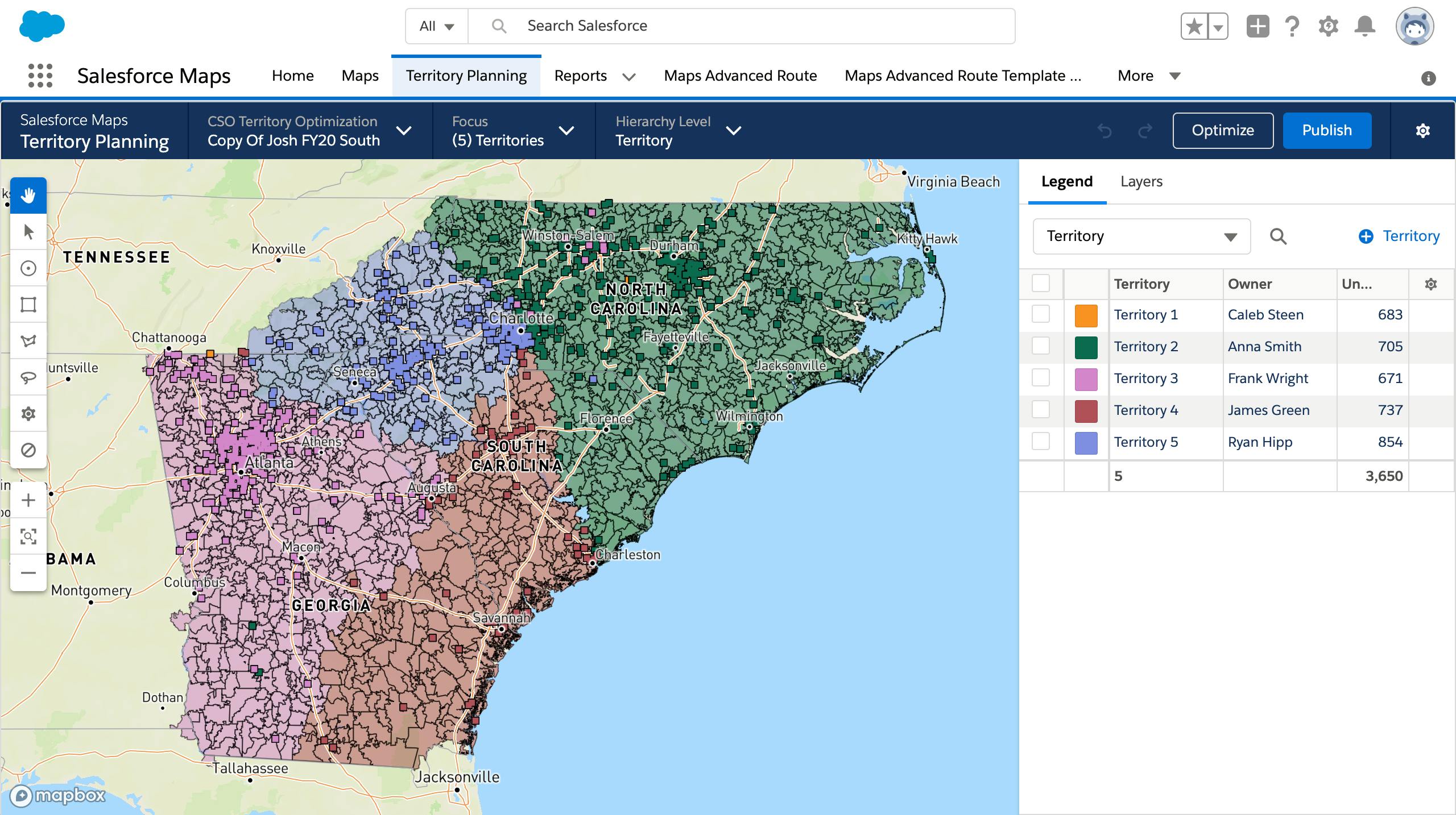
Territory Planning
Eliminate barriers for planning and operations through territory optimisation. Easily design or realign territories to maximise resources and geographic potential.
Salesforce Maps
- Visualise Your Data
- Make Better Decisions
- Take Action
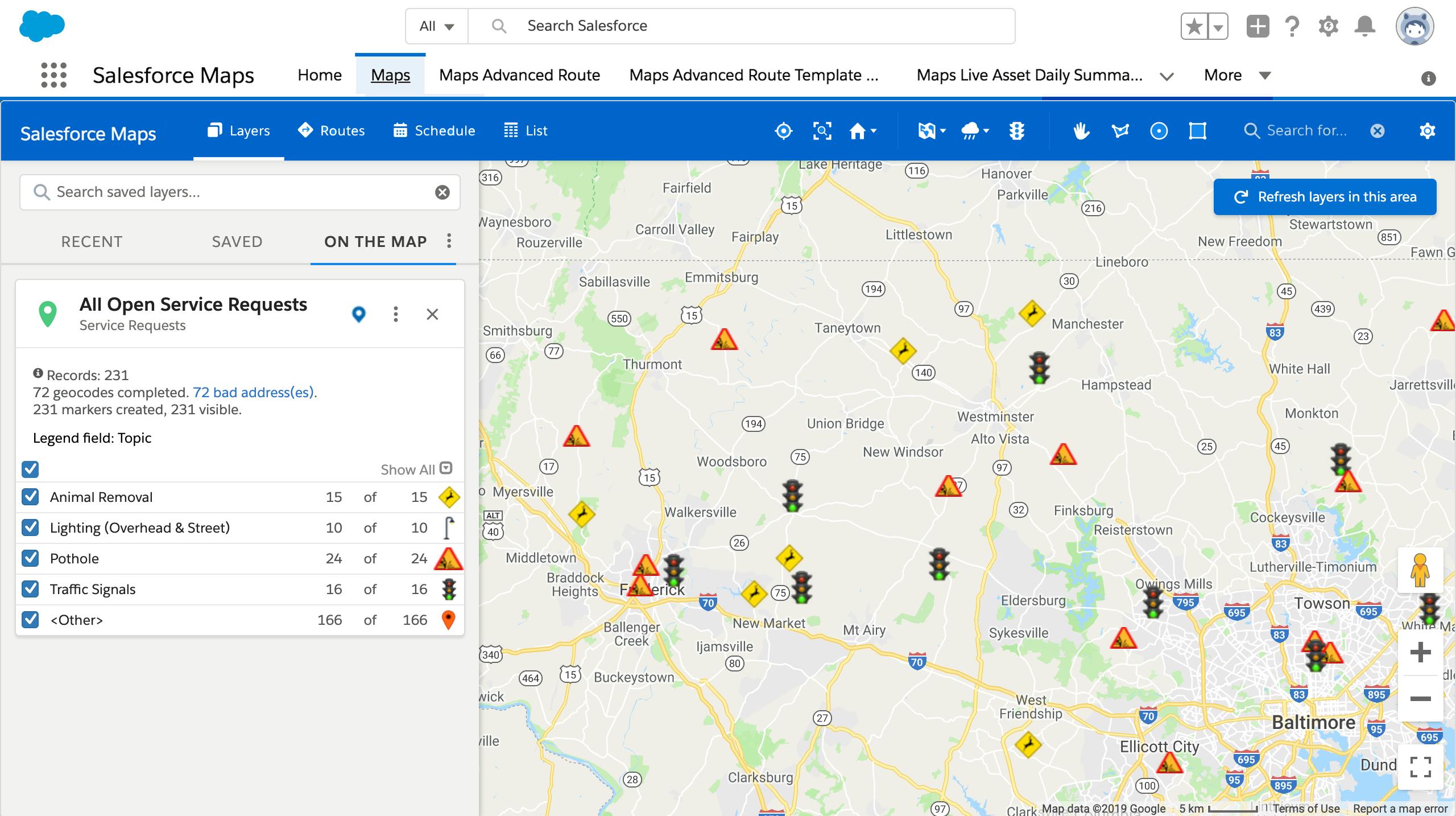
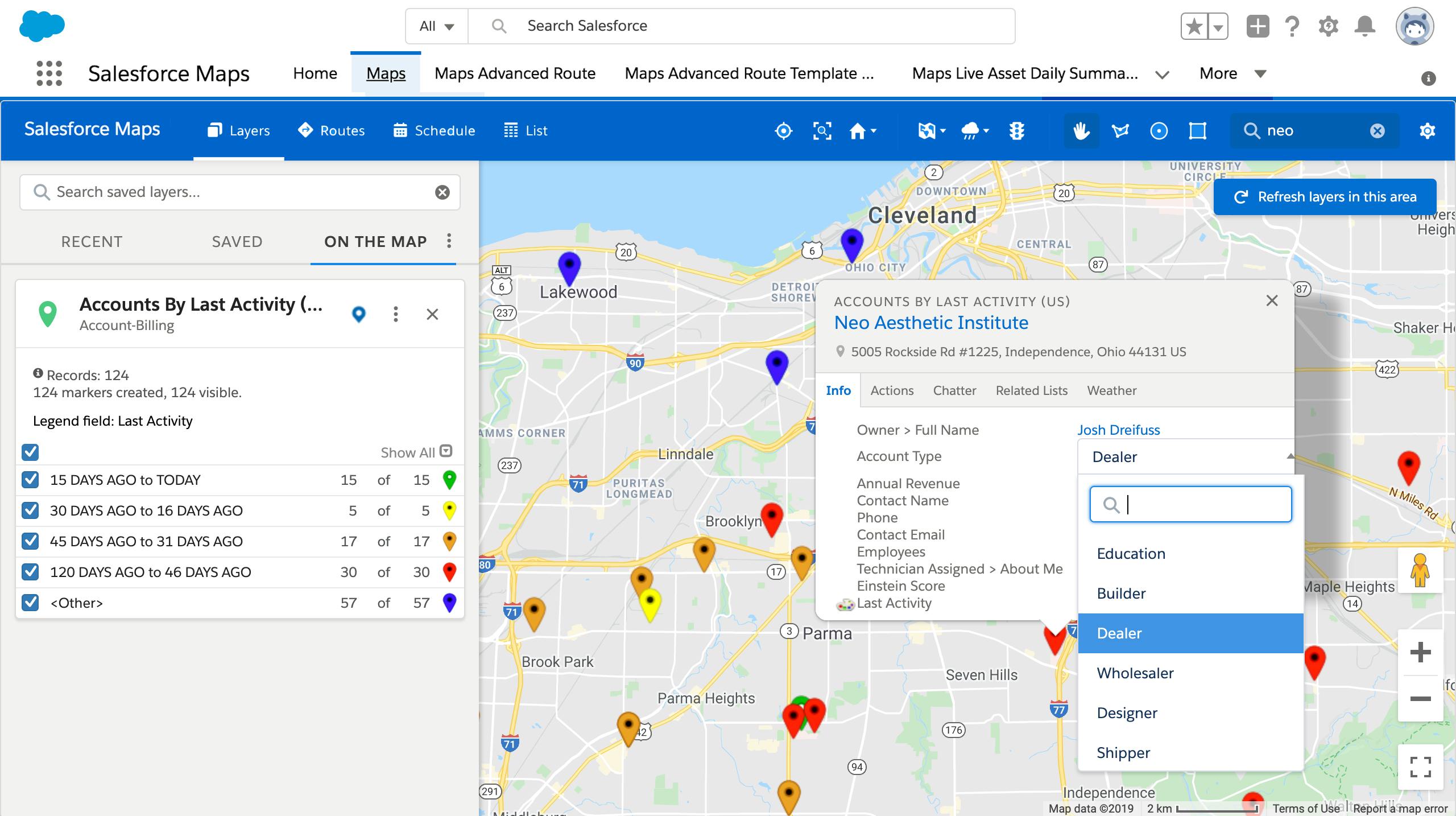
Map-Based Visualisation
With intuitive representation of assets, data and rep staff locations, field teams can visualise their location relative to destinations and work orders for easy interpretation.
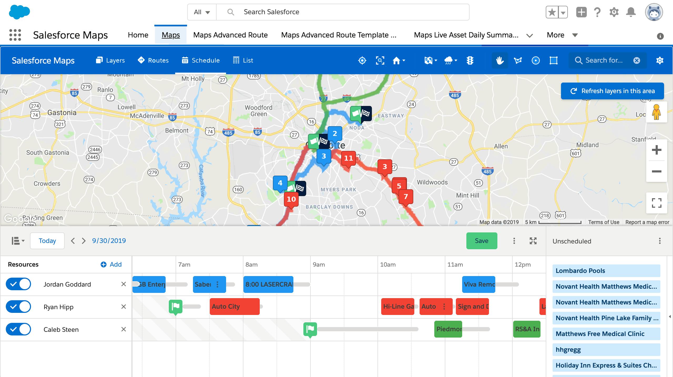
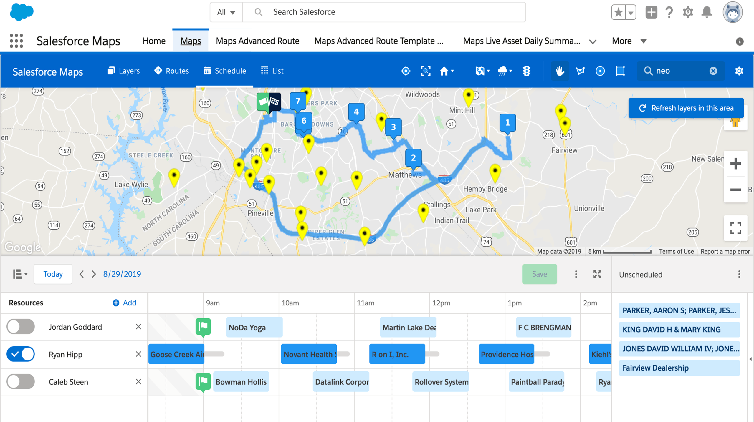
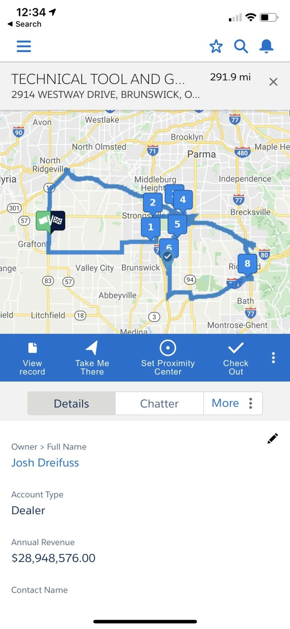
Route Planning
Automate field personnel activity tracking, like mileage logging and check-in / check-out, with geo-fencing capabilities to ensure budget accuracy. Recommend the right course of action to drive optimisation, growth and efficiency.

Mobile Ready
Natively built on Force.com, access all Maps via a mobile device, such as a tablet or smartphone. Easily update and re-optimise routes while on the road to fill schedule gaps or cancellations with nearby customers.
Real-Time Data Updates
Easy inline editing of records in the map interface allows for quick, contextual updates of any record within a single screen. Mass updating allows edits of many records with just a couple of clicks.
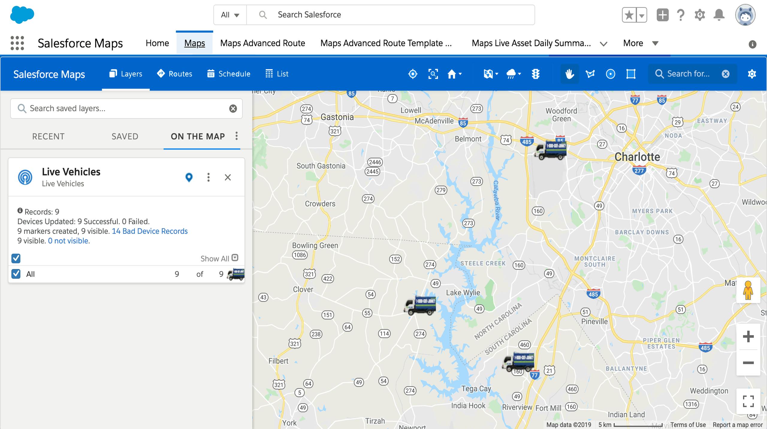
Track Assets and Field Personnel Activity
View Internet of Things (IoT) workflow inside Salesforce. Track and record vehicle telemetrics data in Salesforce. View vehicle and asset locations and statuses in real-time. Streamline operations, boost productivity, reduce costs and improve efficiency.
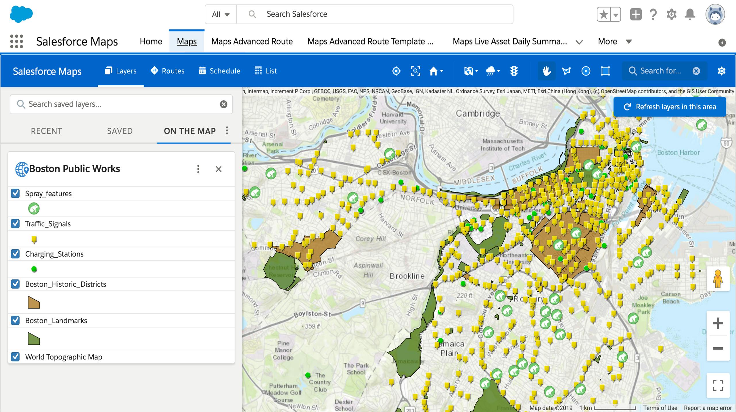
Turn Your ArcGIS Data Into Actionable Intelligence
- Bring ArcGIS data and layers to life in Salesforce
- Automated one-way data sync from Salesforce to ArcGIS
- ESRI-Authorised & Secured
Territory Planning
Eliminate barriers for planning and operations through territory optimisation. Easily design or realign territories to maximise resources and geographic potential.
Salesforce Maps
- Visualise Your Data
- Make Better Decisions
- Take Action
Map-Based Visualisation
With intuitive representation of assets, data and rep staff locations, field teams can visualise their location relative to destinations and work orders for easy interpretation.
Route Planning
Automate field personnel activity tracking, like mileage logging and check-in / check-out, with geo-fencing capabilities to ensure budget accuracy. Recommend the right course of action to drive optimisation, growth and efficiency.
Mobile Ready
Natively built on Force.com, access all Maps via a mobile device, such as a tablet or smartphone. Easily update and re-optimise routes while on the road to fill schedule gaps or cancellations with nearby customers.
Real-Time Data Updates
Easy inline editing of records in the map interface allows for quick, contextual updates of any record within a single screen. Mass updating allows edits of many records with just a couple of clicks.
Track Assets and Field Personnel Activity
View Internet of Things (IoT) workflow inside Salesforce. Track and record vehicle telemetrics data in Salesforce. View vehicle and asset locations and statuses in real-time. Streamline operations, boost productivity, reduce costs and improve efficiency.
Turn Your ArcGIS Data Into Actionable Intelligence
- Bring ArcGIS data and layers to life in Salesforce
- Automated one-way data sync from Salesforce to ArcGIS
- ESRI-Authorised & Secured
Territory Planning
Eliminate barriers for planning and operations through territory optimisation. Easily design or realign territories to maximise resources and geographic potential.